Discover Indiana Logo
StoriesToursMap
Search Menu
Advanced Story Search ▸
Sitewide Search ▸
  • Home
  • Stories
  • Tours
  • Map
  • About
View a Random Story
App Store Google Play

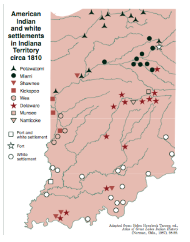
Settlement map

ID: 3270 | This file appears in: The Treaty of St. Mary’s, 1818
A map from around the 1810s showing Naitve and White settlements before the Treaty of St. Mary's in 1818.
| Source: Courtesy of the Atlas of Great Lakes Indian History
Download Original File

Source

Courtesy of the Atlas of Great Lakes Indian History
"Settlement map " appears in: The Treaty of St. Mary’s, 1818
Advanced Story Search ▸
Sitewide Search ▸
App Store Google Play
  • Home
  • Stories
  • Tours
  • Map
  • About
View a Random Story
This work is licensed by Discover Indiana under a Creative Commons Attribution-NonCommercial-ShareAlike 4.0 International License.
Powered by Omeka + Curatescape