Discover Indiana Logo
StoriesToursMap
Search Menu
Advanced Story Search ▸
Sitewide Search ▸
  • Home
  • Stories
  • Tours
  • Map
  • About
View a Random Story
App Store Google Play

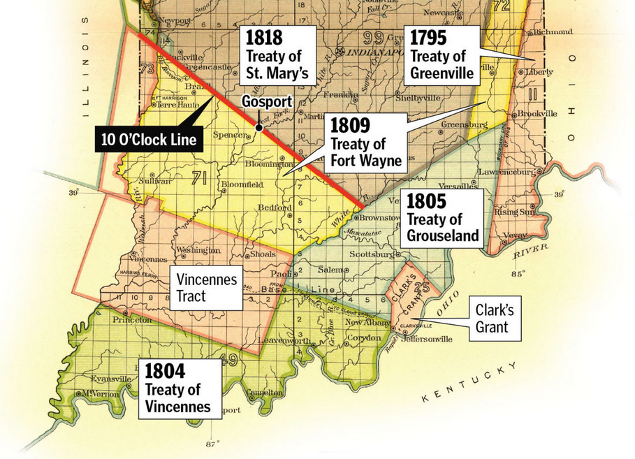
Treaty lines

ID: 3269 | This file appears in: The Treaty of St. Mary’s, 1818
A map showing the dates and treaty lines of several treaties located in southern Indiana. Towards the top shows the Treaty of St. Mary's, the largest section encompassing much of central Indiana.
| Source: Courtesy of the Monroe County Timeline
Download Original File

Source

Courtesy of the Monroe County Timeline
"Treaty lines " appears in: The Treaty of St. Mary’s, 1818
Advanced Story Search ▸
Sitewide Search ▸
App Store Google Play
  • Home
  • Stories
  • Tours
  • Map
  • About
View a Random Story
This work is licensed by Discover Indiana under a Creative Commons Attribution-NonCommercial-ShareAlike 4.0 International License.
Powered by Omeka + Curatescape