Lake Co. Map
This file appears in: Construction of the Town
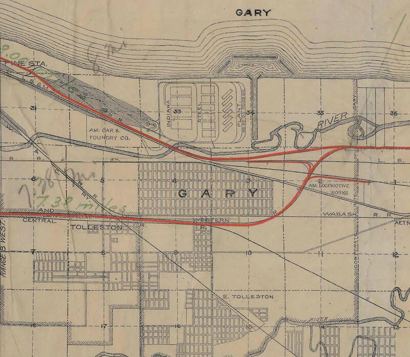
A map of the industrial areas of northern Lake County, circa 1909. Gary’s First Subdivision is visible below the US Steel plant and above the Wabash Railroad, indicated with a red line. From east to west the First Subdivision ran from Tennessee Street to Fillmore Street. Laid out into over 100 blocks, each block in the First Subdivision was plotted with 26, 40, 42 or 44 lots.
This file appears in: Construction of the Town
Construction of the Town
US Steel needed laborers to build its steel mill and the city of Gary. A subsidiary of the steel mills, the Gary Land Company was tasked with constructing the town as well as housing for its workers. The Gary Land Company hired engineers such as…
